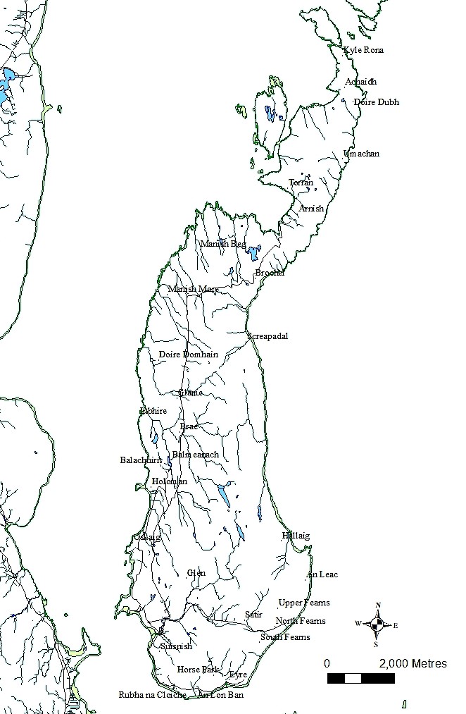
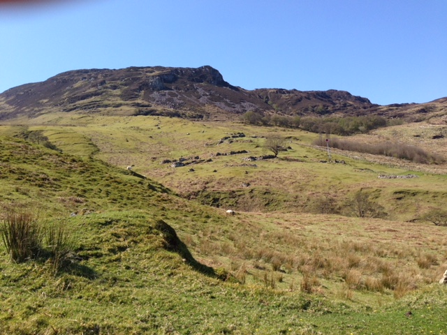
From at least late medieval times, people in Raasay seem to have mostly lived in clustered settlements called townships. Nineteen townships were named in late 16th century charters. The thirty townships on this map are those that were inhabited in the 19th century. ACFA surveyors made detailed maps of the features of these townships, which form the basis for analysis in Raasay: The ACFA Archaeological Surveys, and details about the archaeology and history of each township can be found in the book, and in the ACFA reports. The maps here come from the annual reports of the ACFA surveys by John Macdonald and Scott Wood.
Oskaig
In 1995 the survey of Oskaig and Holoman identified 39 features in Oskaig, and in 2006 another 12 features were recorded in Oskaig plantation, south of the current settlement. As in other townships, these features include houses, byres, stores, shelters, or simply ‘structures’ whose purpose is not apparent.
Holoman
Eleven of the features at Holoman were identified as houses or house/byres. Four of these are in “East Holoman’, which is the area above the main township, and south of where the road bends. Only five of these eleven houses are described as ‘ruinous’, the rest having substantial walls standing over a metre high. Two of these buildings are, thought to be the remains of the Gaelic School. As the census records show, people lived in Holoman right through the nineteenth and early twentieth centuries, and it is likely most of the more upstanding houses represent the homes of these tenants.
Balmeanach and Balachuirn
Of the twenty-seven features identified at Balmeanach, three were clearly houses. There is considerable evidence of agricultural activity, including clearance cairns and field banks of various ages. One house, not included in the survey, is still occupied.
Balachuirn (the town of the cairns) is separated from Balmeanach by Loch Eader da Bhaile (the loch between two townships). In addition to nine houses there are barns, clearance cairns and enclosures
Inbhire
Inbhire has four upstanding houses, and nine ruinous houses. The township does not appear in documents after the 17th century, so it is uncertain whether the houses were counted in the census with another township, or whether they are older than they appear.
Brae
Brae is located either side of the road, and contains two upstanding houses, along with the usual assortment of barns, clearance cairns, and other structures. It seems to be the location of one or two individual farmsteads.
Glame
Glame is currently used for gathering and shearing the island’s sheep. Though the township is named in the earliest charters (1596), none of the features visible seem to be that old.
Manish More
The township of Manish is named in the earliest records, though now it is recorded as Manish Beg and Manish More (Little Manish and Big Manish). Manish More has remains of a number of houses, as well as extensive agricultural remains and prehistoric hut circles.
Manish Beg
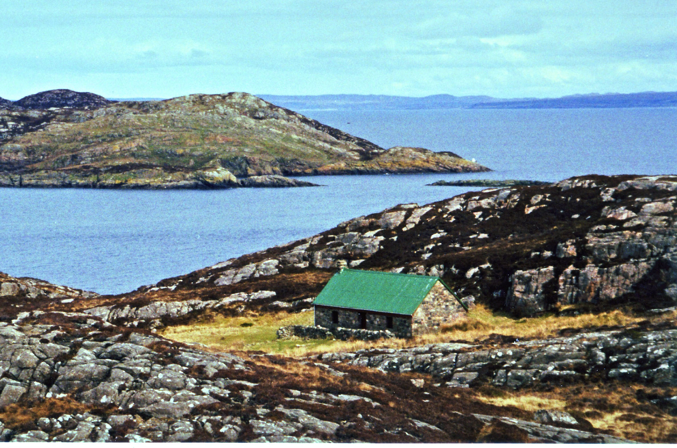
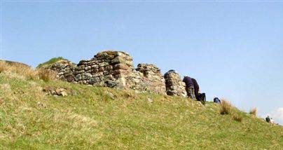
Manish Beg has 22 structures, including houses (like the one in the illustration here), byres, stores, and a corn drying kiln. It is surrounded by extensive field systems and grazing lands.
Brochel
Of the 55 features noted at Brochel, eleven are house. The shape of some of them suggests they were occupied over a long period of time. Many other structures may have once been houses, and later re-used as barns and byres.
(Photo: Ari Fertig)
Screapadal
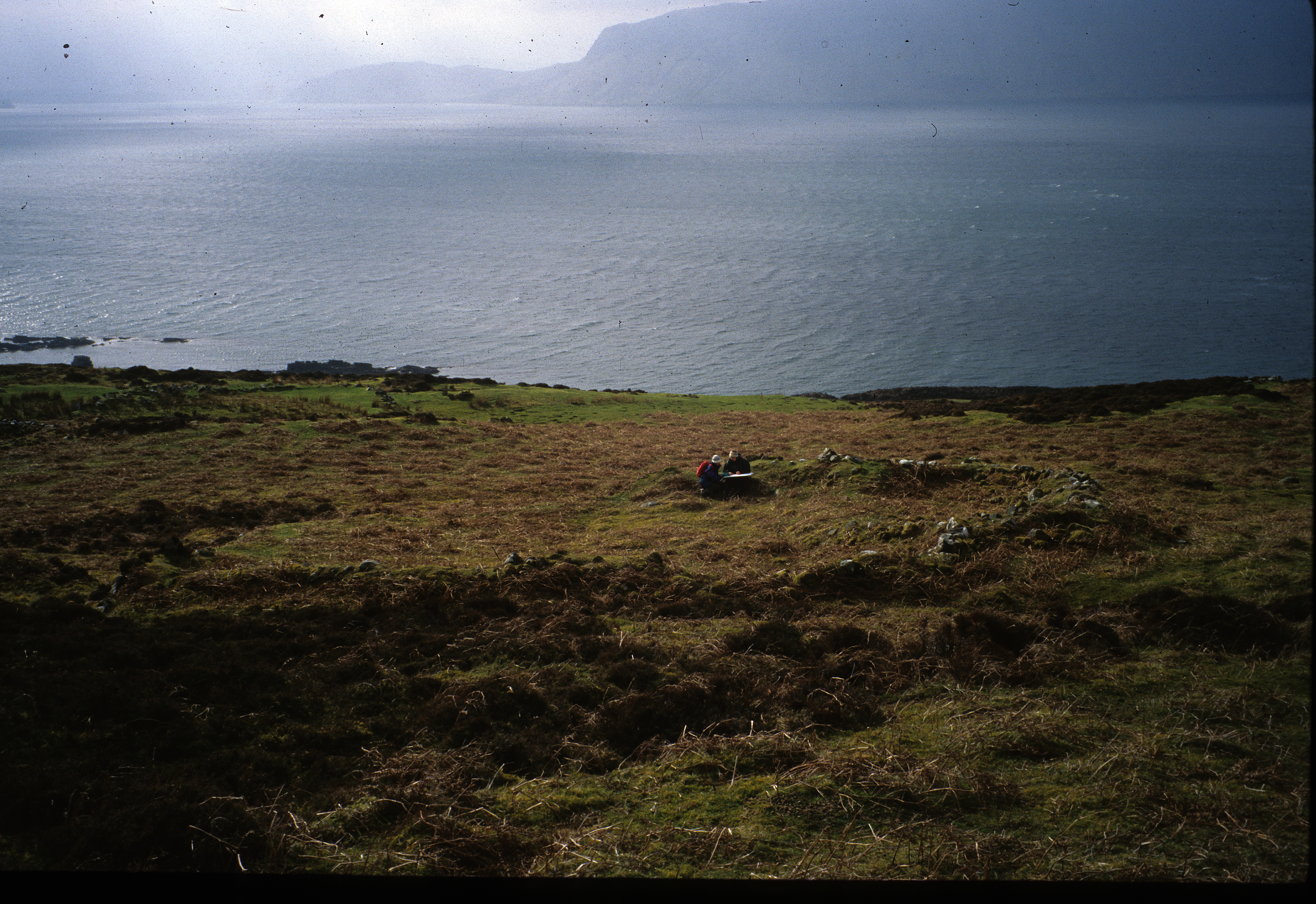
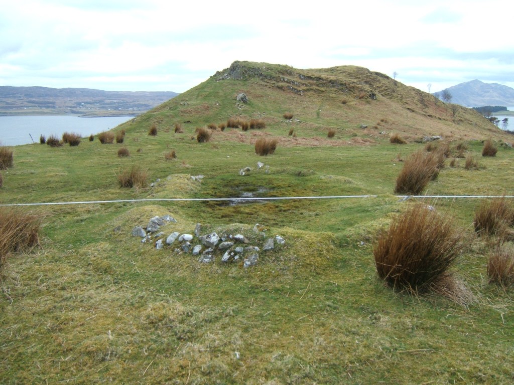
Screapadal is one of the largest, and best-preserved of the southern townships; it was depopulated in the 1850s to make a sheep farm. Screapadal can be reached by a foot along a track from the road just west of Brochel. Divided into two sections by An Leth-Allt, there are about 40 structures, of drystone construction, with walls standing to nearly their original height. Boswell described visiting one of these houses with Dr. Johnson in his Tour of the Hebrides (1785) Above the township structures can be seen an extensive field system with areas of rig, and closer to the shore in North Screapadal are several boat noosts. The photo shows North Screapadal, seen from the southern bank of An Leth-Allt.
Hallaig
Hallaig was cleared by 1861, when the land was let as a sheep farm. It is an extensive township, with 33 features identified as houses, and many very ruinous, turf-covered remains which may have been earlier houses, re-used as barns and then robbed of their stone to construct newer houses nearby. Above the township’s head dyke are extensive field systems.
An Leac
This small settlement is to the east of the track running south from Hallaig. It has just seven houses, within an irregular enclosure. An Leac is perhaps the settlement Auldali, recorded in 1596 as being between Hallaig and Fearns. It was cleared in 1854.
Fearns
Fearns is by far the largest and most extensive township on Raasay. In the 1851 census 40 families are listed as living in Fearns (sometimes divided into North and South Fearns, or Upper and Lower Fearns), but emigration from Fearns started in 1803, and after 1854 only two families, probably associated with the sheep farm, lived there. The surveys, conducted over three separate seasons, identified 35 houses in North Fearns and 11 in South Fearns. In addition, barns, byres, stores, and enclosures were noted. Above the main settlement are numerous sheilings. As in other townships, there is some evidence that older buildings were reused and then their stones were robbed for use in later buildings. Clusters of structures suggest Fearns is the amalgamation of a number of smaller, earlier settlements.
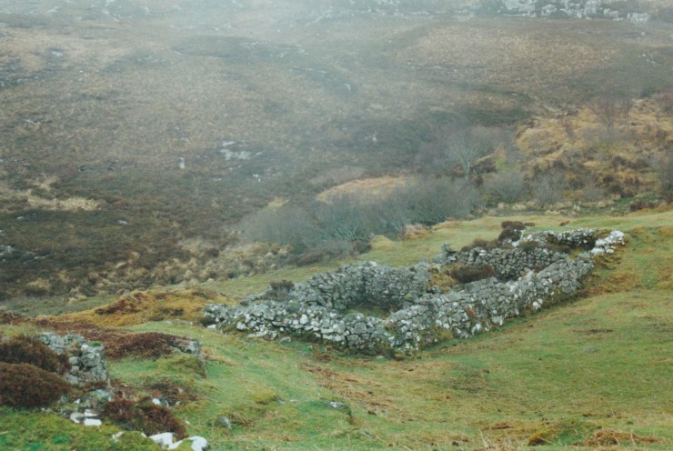
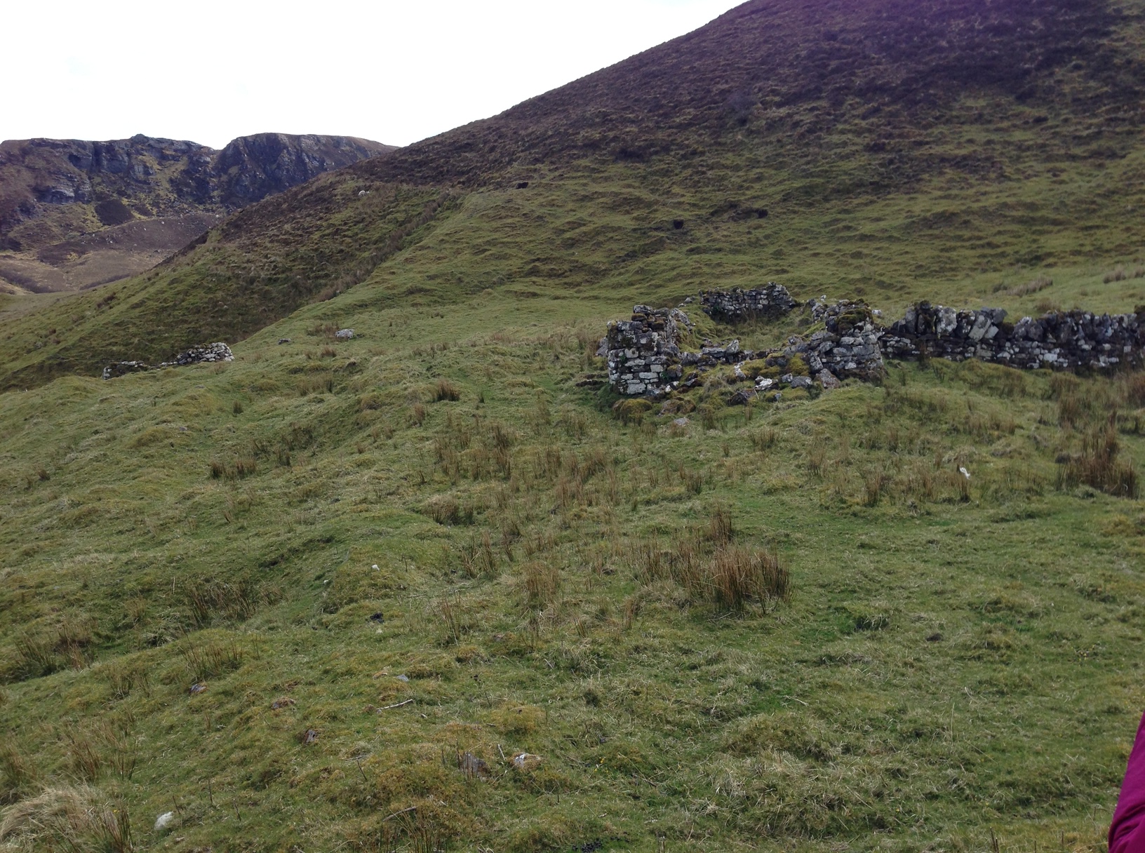
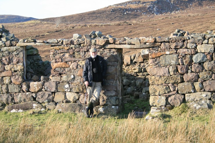
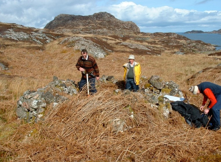
Suisnish
Suisnish, on the south shore of Raasay, is also extensive, with 51 features spread out over a large area. Ten of these were identified as houses. The settlement was occupied for a long time, appearing in the 1596 charter and subsequent documents. Some of its buildings, like the one below, have been rebuilt or reused as modern barns or shelters.
Eyre
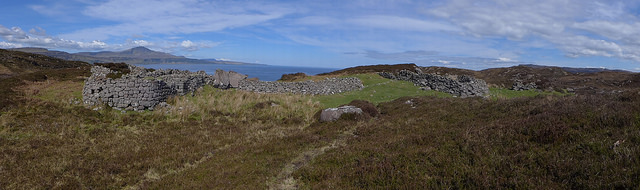
Eyre is most well-known for its numerous Bronze-Age burial cairns. However, the township is named in the late 16th century charters, and surveys of the area identified 76 features. In addition to fifteen houses, some still upstanding like the Piper’s house in this illustration, there were cairns, enclosures, quarries, rig, and field banks, indicating the location of much activity over many years.
Arnish
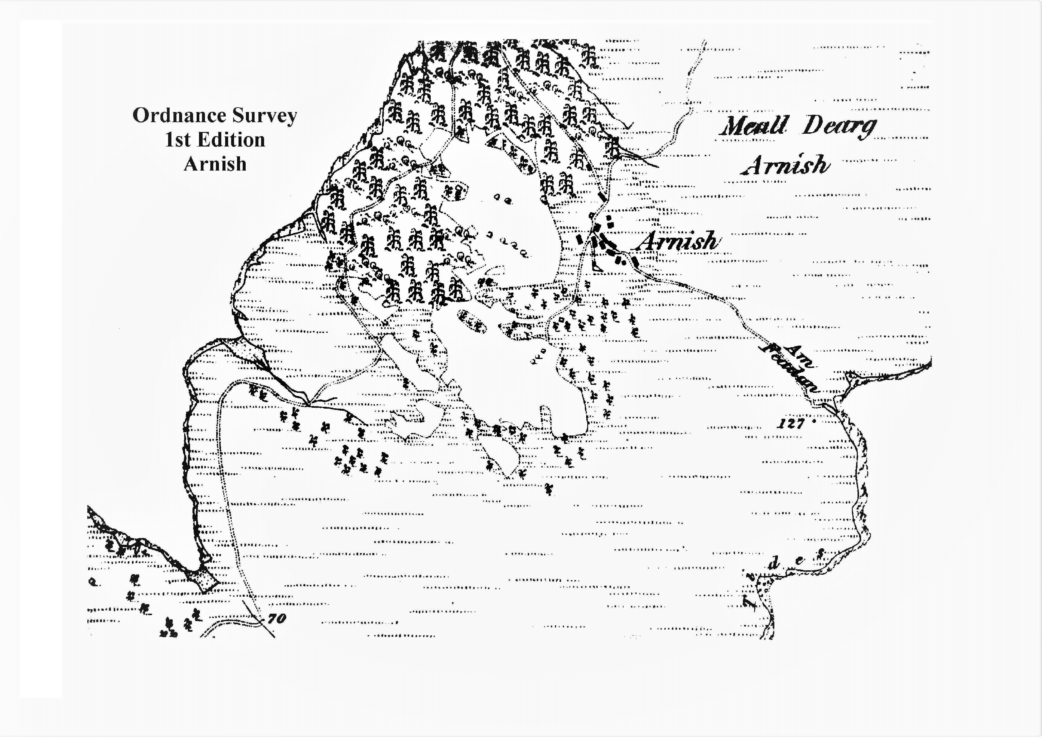
At the north end of Raasay are several more townships. These are reached by the road from Brochel, and then by footpath. Most of these townships were more recent creations than those in the south of the island, probably because the land in the north is much more rugged and rocky. The only northern township to appear in early records, Arnish is spread over a large area, and not all the structures appear on the First Edition Ordnance Survey map published around 1880 (see illustration). The surveyors recorded 45 structures, including 13 houses (plus two that are currently occupied).
Torran
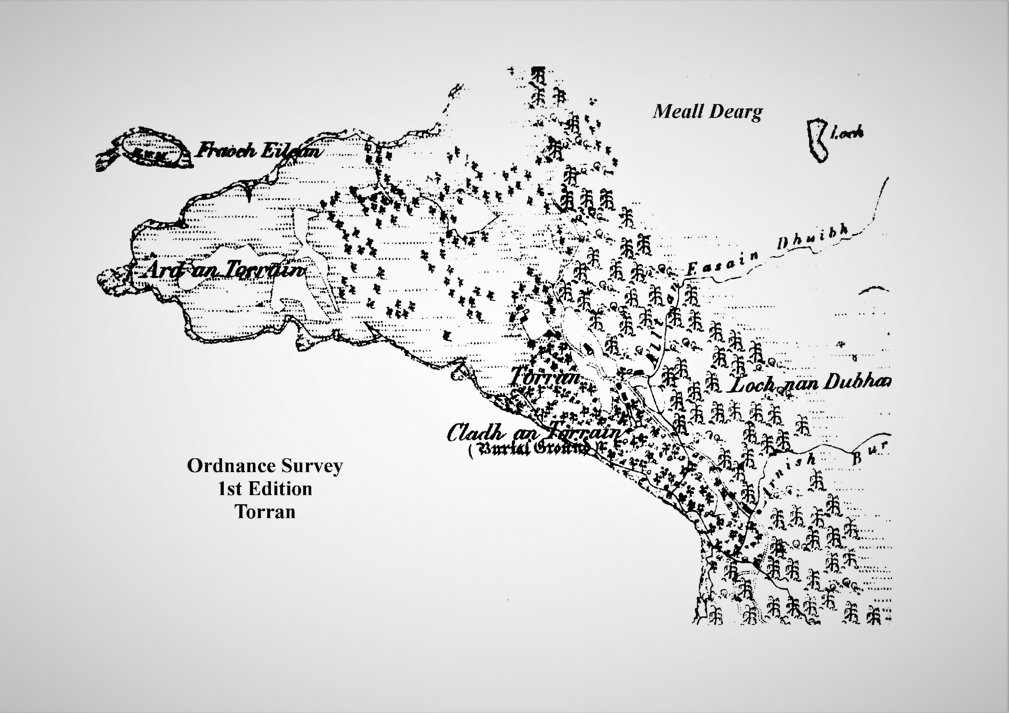
Like Arnish, Torran is spread over an extensive area on the west coast of the north end of Raasay. It is first mentioned in a rental record of 1827. Nevertheless, it was an important place in the north end, as the location of a post office, a school, and a mission house. Nine houses, including the Mission House and Post Office house, were identified, including two that are still occupied.
Umachan
The settlement of Umachan, on the east coast, consists of nine houses and about 60 other features, including the usual barns, byres, stores. It has always been remote and difficult to access, and the small patches of land that were improved for growing crops testify to the difficulty of making a living here. It appears in the rental records if 1827, and is finally abandoned in the 1940s.
Doire Dubh
Doire Dubh is nearly 5 km north of the end of the road at Arnish, in a very rocky inlet. Five houses, and ten other structures are recorded here. The township first appears in the 1861 census, where men’s occupations are listed as fishermen, and at least one boat noost was identified by the surveyors.
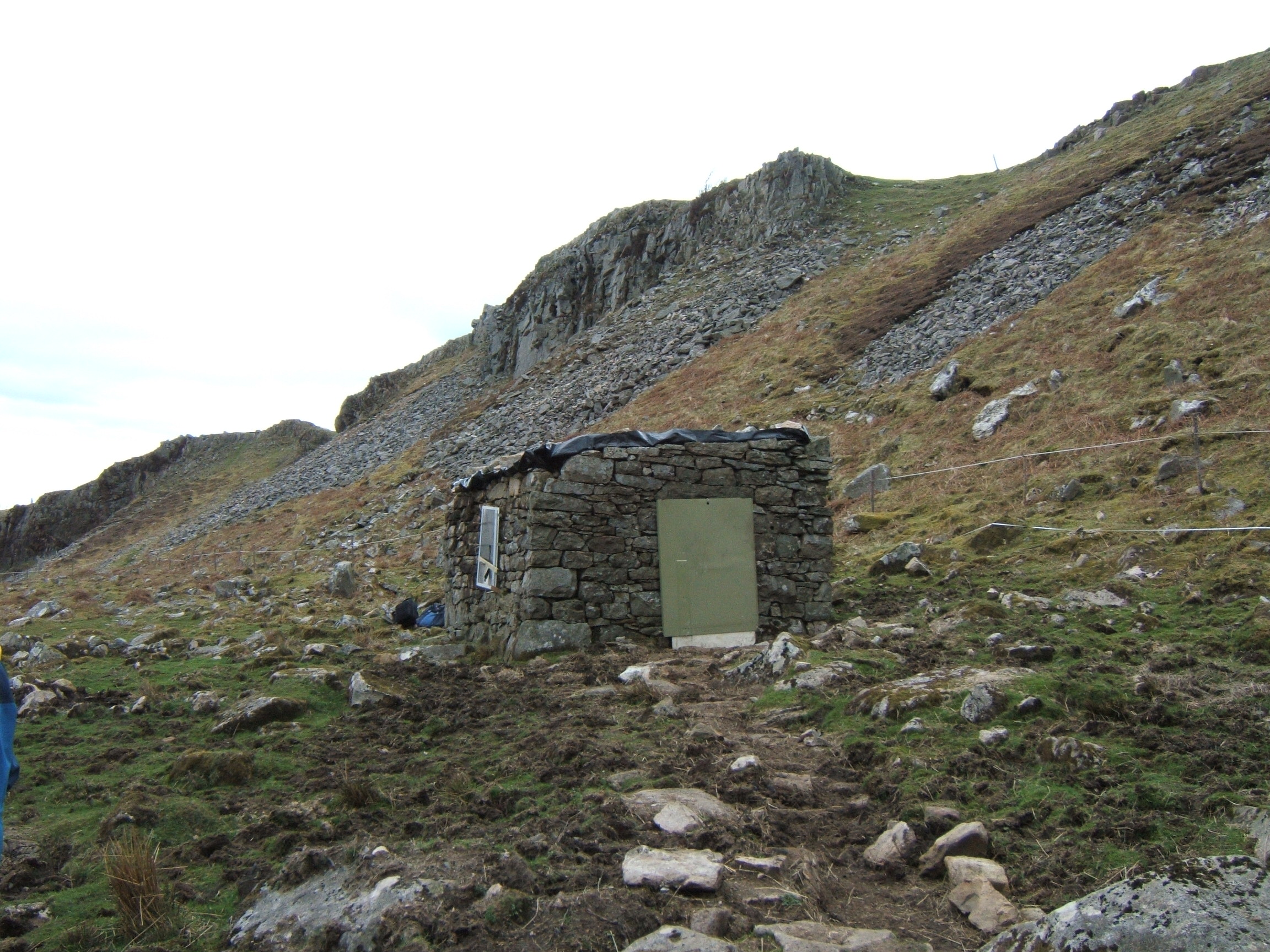
Kyle Rona
At the very northern tip of Raasay, Kyle Rona is a scattered settlement of 19 houses (including the upstanding Bothy) and 50 other features. Some of these features may have been prehistoric, including the rockshelter at Loch a Sguirr. The rent records record people performing a number of different occupations: weaving, tailoring, and farming. But in 1841, six adults were recorded as paupers, and six were agricultural labourers who did not possess any land themselves.