The ACFA surveys identified 2091 individual structures or features on the island! These include prehistoric and historic houses, livestock enclosures and agricultural structures, a castle, sheilings, cairns, and rockshelters. A few of these, such as the castle and the Pictish carved stone, had been recorded previously, and some were investigated further by other archaeologists, but most first recorded by the ACFA surveys.
Prehistoric features (about 10,000 BC – 500 AD)
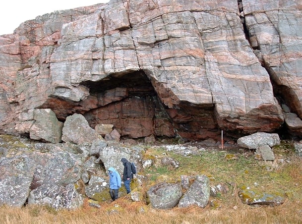
The earliest inhabitants of Raasay arrived about 10,000 years ago, in the period archaeologists term the Mesolithic. The remains of their campsites have been found along the shore, and in rockshelters like this one at Loch a Sguirr. These folk were hunters, gatherers, and fishing people.
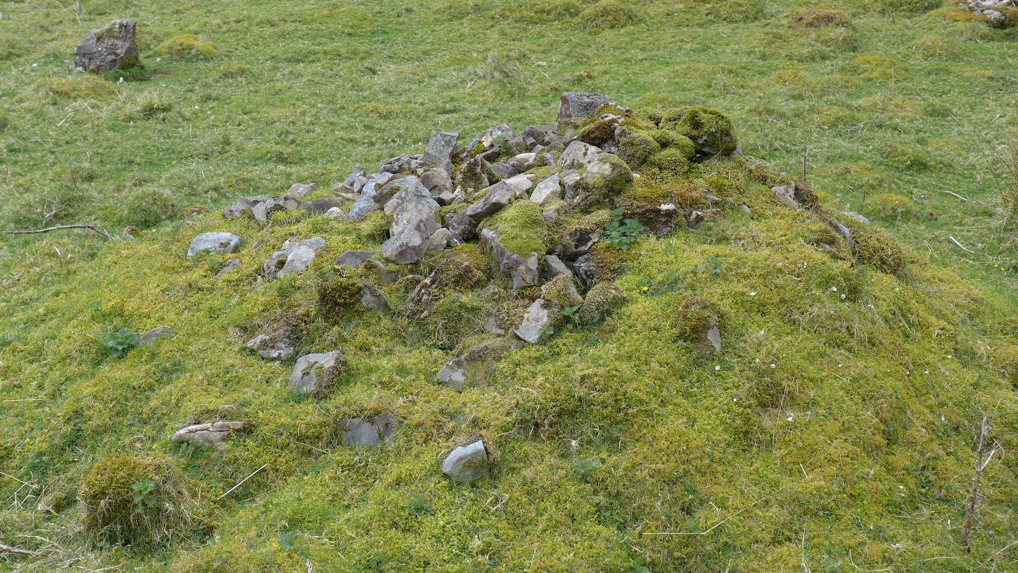
Later, around 4000 BC, people in Raasay started to herd animals and raise some crops. These Neolithic people buried their dead in large circular, stone covered cairns. People continued to be buried under stone cairns into the Bronze Age; this cairn at Eyre is an example of one of these burial sites. Originally it would have been covered in stone and earth. There are remains of many cairns around Eyre.
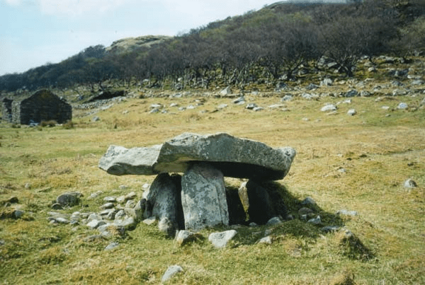
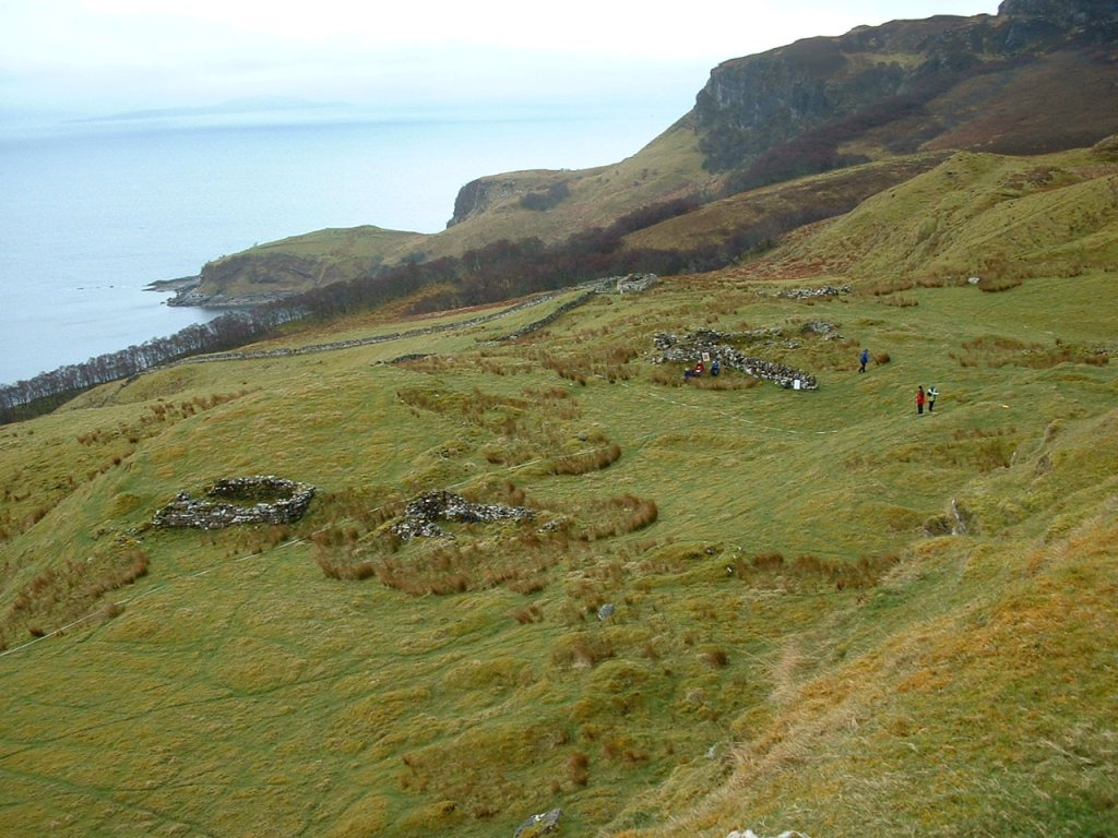
Prehistoric houses, sometimes referred to as ‘hut circles’ are probably from the Iron Age (about 850 BC- 500AD) or Bronze Age (about 2500 BC – 850 BC). They are usually round rather than rectangular, and average 7.5 m in diameter. This circular feature near the Fearns Road is a good example of a hut circle – really, a substantial house that would have been roofed with timber and thatch.
These tumbled walls are what remains of a broch, Dun Borodale. When in use in the later prehistoric period, it would have been a round tower several stories tall, with internal steps and galleries. At the time of the ACFA surveys, the Broch was covered in forest; AOC did a detailed survey in 2012, and their report can be found here: https://librarylink.highland.gov.uk/LLFiles/245526/full_245526.pdf. The site is now a Scheduled Ancient Monument.
Medieval Features (about 900 AD – 1600 AD)
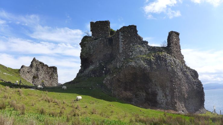
The most visible evidence of medieval life on Raasay are the ruinous Brochel Castle and the medieval church dedicated to St. Moluag. The castle is surrounded by the remains of houses and byres, but it is not certain that any of these were occupied in the middle ages. Many of the other settlements in Raasay were named in later medieval documents, so we expect that they were occupied in this period, but it is not possible to do more than speculate on which features of the settlements are that old. Based on comparisons to medieval sites excavated in other parts of Scotland, we guessed that about 115 features might be medieval, including houses and sheilings.
Sheilings
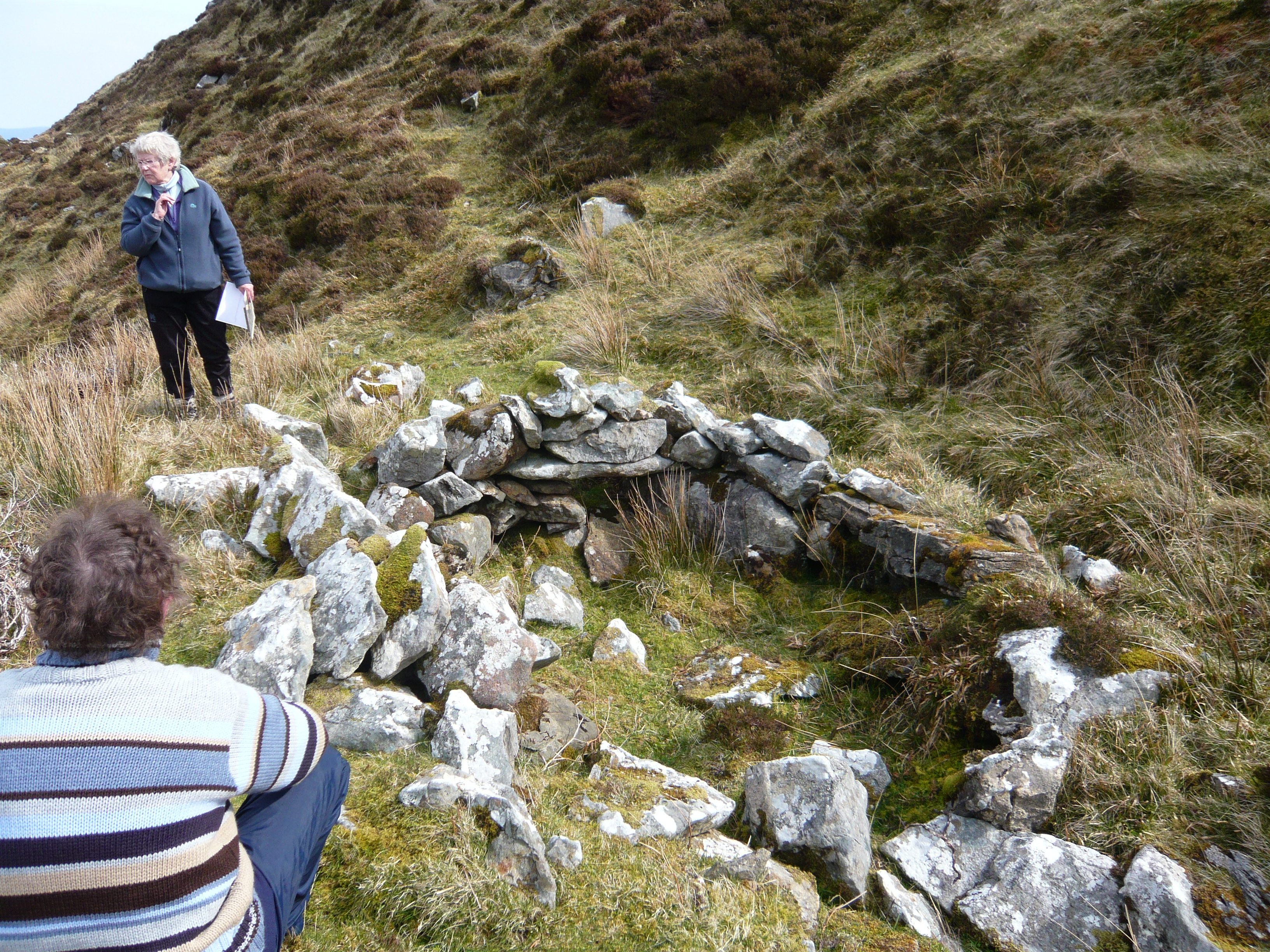
The ACFA surveys identified over 250 features as sheilings. There is no historical or local knowledge of the practice of sheiling – of taking animals to summer pastures away from the main settlements – in Raasay, but the features like this one that we found throughout the island, mostly in the hilly ground above townships, strongly resemble sheiling features in other parts of Scotland. Perhaps these had their origins in the medieval period, and the practice had died out by the time our historical records begin.
Post-medieval features (18th – 20th centuries)
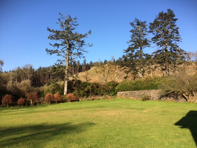
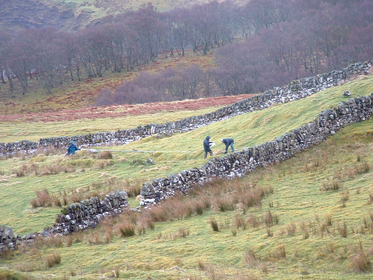
Most recent historic period features are clustered in and around the townships (see Raasay Townships). These features include houses, byres and barns, enclosures, and fields.
About 300 features were identified as house foundations by the surveyors. Some of these were ‘longhouses’, which included areas for people to live in, and areas for animals to live in. Others seem to have been just for people, with animals housed in separate byres nearby. Most historic houses were rectangular in shape. The earlier houses had rounded corners, and later houses had squared corners. On average, houses were about 10 m long, and 4 m wide.
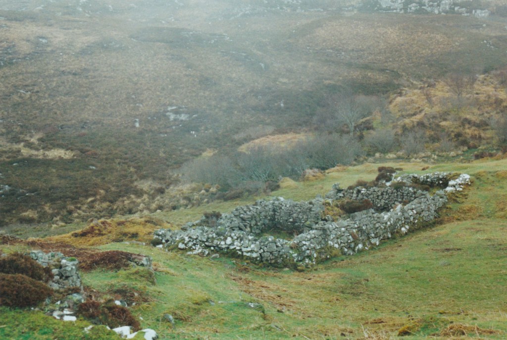
Byres and barns were often located near to houses, and were distinguished by being smaller than houses, and having small holes in the foundations that served as drains for animal waste. In this photo of Hallaig, older, grass covered foundations of houses and barns, and more recent, probably 19th century stone house and barn foundations can be seen clustered in small groups. Each group may have comprised the house and byres of one family.
This large sheep fank, built after the township of Hallaig was cleared to make a sheep farm, indicates the type of enclosure people built throughout the historic period to contain their animals. Inside this enclosure you can see the low turf-covered remains of other walls, perhaps representing earlier enclosure walls.
People grew crops in small fields, wherever they found fertile soil. These can be identified by the remains of the ridge and furrow (‘rig‘, picture on the left) and by the presence of clearance cairns (picture below), where the stones from the fields were piled up.